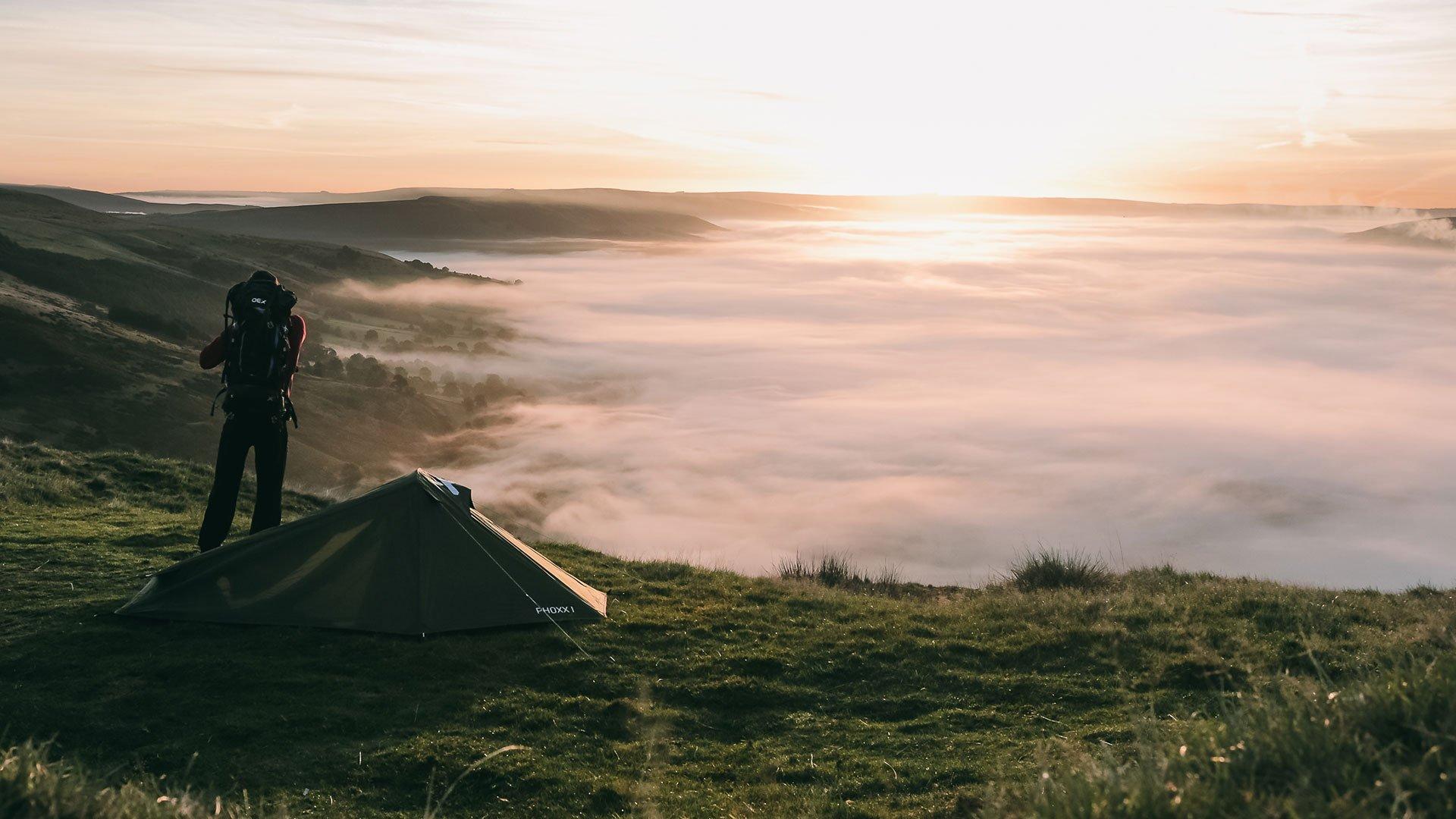
National Walking Month | Our Top 10 Walks in the U.K.
In the spirit of National Walking Month, we have put together our top 10 walks in collaboration with OS GetOutside Champions from across the UK.
These outdoor heroes have walked the length and breadth of these fair isles, discovering some truly hidden gems. So whether you're looking for a new challenge or just want to get the kids off the sofa for a few hours, there’s something for everyone in this easy to use guide.
1. Worcestershire Way
West Midlands | 44.5km/27.7 miles |1,560m ascent | 11 hours 29 mins | Rating: Difficult
Parking: Located at the start of the trail in Dog Lane, Bewdley. Also available in Malvern at the Quarry Car Park. Grid ref: SO768470, Postcode: WR14 4LY
The Worcestershire Way is a trail route taking you from Bewdley to Great Malvern. It can be completed in one day but for a more leisurely walk take 2 days.
The path starts on the River Severn at Bewdley and is a fairly flat and pleasant walk. It is mostly riverside and woodland walking with gentle hills throughout. The route has lots to offer including Birchwood Common, where Sir Edward Elgar composed most of his music.
Finish is at the outstanding and beautifully scenic Malverns Hills, situated at 425m above sea level.
The trail itself is marked with OS Mapping Waymarkers, displaying a green pear on named discs.
TIP: If you have time, you can extend your route to finish at the iconic British Camp - an Iron Age Hill Fort.
Discover the Ordnance Survey Map for the Worcestershire Way route
(Thanks to OS GetOutside Champion Anna Humphries)
2. Old Winchester Hill
South East England | 13.3km/8.3 miles | 3 hours 18 mins | Rating: Moderate
Parking: Room for about 6 cars. Grid ref: SU 59677 22551, Postcode: SO32 3LN
This is a beautiful walk on the western edge of the South Downs National Park, providing a taste of what the Downs can offer and passing two excellent pubs en-route. It follows sections of the South Downs Way and the Monarch's Way, starting and finishing at the car park on top of Beacon Hill within the Beacon Hill National Nature Reserve.
Leaving the car park, the Monarch's Way leads downhill to the Wheely Down Farm - look out for the whale on the lawn! Continue downhill, past the Hampshire Hogs Cricket Ground into Warnford, looking out for the Water Cress 'fields' on your right. Opposite the George & Falcon pub, head uphill onto the South Downs Way and the Iron Age Hill Fort of Old Winchester Hill.
Descend back down into the Meon Valley, crossing the Meon Valley Trail which was formerly a railway line where Winston Churchill, General Eisenhower and other senior Allied Leaders met on a train prior to the D-day invasion. Having crossed the busy A32 you enter the quaint village of Exton where you will find the Shoe Inn, another excellent pub.
The final stage of the walk is the climb out of Exton back up to the top of Beacon Hill and the car park via the trig pillar. On a clear day the views from the walk are magnificent, seeing the coast and Isle of Wight to the south and well up into Surrey to the north. This is a walk you will never tire of.
Discover the Ordnance Survey Map for the Old Winchester Hill route
(Thanks to OS GetOutside Champion Glyn Dodwell)
3. Hole of Horcum
Yorkshire and The Humber | 15.4km/9.6 miles | 4 hours 2 mins | Rating: Moderate
Parking: Saltergate car park on the A169 from Pickering to Whitby. Grid ref: SE 852 936, Postcode: YO18 7NR
The Hole of Horcum makes for a spectacular moorland adventure, offering a scenic half-day loop with views and terrain as varied as they come. The 9 and a half miles of easy-to-follow but wonderfully picturesque footpath starts with a dramatic view across the Hole of Horcum itself; on a clear day you can see much of your route for the day from the carpark.
Walkers start by looping around the top of the Hole of Horcum across Levisham Moor, taking in an array of Bronze Age and Iron Age remains (the majority of which are marked with small ground-level information stones), and through what is said to be some of the UK’s best grouse breeding grounds.
The hole, a crater like hollow, is 400 feet deep and just under a mile wide – very significant on the landscape. Otherwise known as the "Devil's Punchbowl", local legend suggests the amphitheatre was formed suddenly when a Giant scooped up some earth to throw at his wife during an argument. The reality is that this is an example of spring-sapping, where water flowing inside the hill has eroded the landscape from the inside; the once narrow valley widened and deepened over thousands of years, and it is still getting bigger by the same process even now.
The route sweeps down the hill to Dundale Pond, where you reach a finger board with four possible route options (or five including turning around and going back the same way). I highly recommend adding on the there-and-back diversion from here to the ruins of Skelton Tower for even more spectacular views over the North York Moors. Time your picnic with the North York Moors Railway for one of the most popular Instagram-worthy snaps of the outdoors, as the steam train makes its way through the valley below you.
Back at Dundale Pond, the circular walk continues through farmland to Levisham, a beautiful little village inside the National Park. The Horseshoe Inn makes for a welcoming walker-friendly lunchtime stop.
From Levisham, the footpath heads along a single-file forest track which can be muddy and rooty at times. It winds walkers down into the valley to meet Levisham Beck, another beautiful spot with a different kind of view to those seen earlier in the hike. Cross the stream and follow the path across the meadow past a large derelict farmhouse, through the Hole of Horcum itself up onto the top and back to the viewpoint to complete the loop.
Discover the Ordnance Survey Map for the Hole of Horcum route
(Thanks to OS GetOutside Champion Zoe Homes)
4. Crib Goch
Wales | 11.1km/6.9 miles | 3 hours 58 mins | Rating: Difficult
Parking: Limited in Pen-y-Pass car park. Nant Peris for park and ride. Grid ref: SH 647557, Postcode: LL55 4NY
As one of the most popular Grade 1 scrambles in the UK, Crib Goch is the toughest walking route up Snowdon, beginning along the PYG track. As its popularity would suggest, the route is quite accessible by public transport (Sherpa buses from all the major towns nearby,) as well as by car, and starts from the top of Pen y Pass which has a decent café and public toilets, as well as Mallory’s Bar in the YHA across the road from the car park. Although it may be easy to get there, the walk itself is not to be underestimated and should only be attempted by walkers confident in both their ability and their route-finding. Further to this, calm winds and dry conditions are almost essential, as anything else can make for a difficult day, with ice axe and crampons absolutely required if completing the traverse in winter.
Crib Goch is a ridgeline climb with incredible views wherever you look and some exciting, proper scrambling. The most exposed part of the walk is probably crossing the pinnacles with a couple of airy steps to conquer, whilst Crib y Ddysgl is always more of a scramble than you think it is going to be!
After that the going gets easier up towards Snowdon. There is a special moment when you reach the summit when, views permitting, you look back at the ascent that you’ve just made. It’s a really special climb and always well worth the effort.
From Snowdon though, there’s a choice - head into the very characterful Llanberis for a wander around the shops, maybe get a bite at Pete’s Eats as a reward, take a wild swim in the lake, or a trip into Electric Mountain and learn about the history of the area. Alternatively, you can head back towards the starting point of the scramble via Y Lliwedd (as shown in this route), and view Crib Goch yet again but from a different angle and in all its glory. This is something well worth doing in the summer to avoid the throngs on the main path of Snowdon.
The exposure and proper scrambling that the route entails is always a thrill and makes for a great day out, especially when there are so many different routes to descend from the summit of Snowdon with. During long summer days, the sheer volume of walkers out on the ridge can make the going slow. Early morning starts or even afternoon starts if confident enough can be particularly rewarding when the light hits the mountains just right. Crib Goch really is one of those real treasures of a walk - and there is no doubt in our minds that it’s one of Britain’s best.
Discover the Ordnance Survey Map for the Crib Goch route
(Thanks to OS GetOutside Champion TwoTravlrs)
5. 5 Peaks in the Pentlands
Scotland | 17.1km/10.6 miles | 4 hours 51 mins | Rating: Difficult
Parking: The Regional Park car park behind the Flotterstone Inn. You can also get to the Pentland Hills by bus from Edinburgh. Grid ref: NT 20638 63348, Postcode: EH26 0PP
Ask an Edinburgh local where they head for a walk and the Pentland Hills Regional Park will be high on the list. There are lots of low-level Pentland Hills walks to explore, including reservoir rambles and moorland strolls which are great for a dog walk. However, for something a little more strenuous, getting up into the Pentland Hills themselves is a brilliant day out – with wonderful views across to Edinburgh. Once you are up in the hills you could be in the highlands, not just 30 minutes from the city centre!
The five main peaks of the Pentland Hills can be walked in a 10-mile circular which also takes in the highest hill in the range, Scald Law. The route starts with a climb up over Turnhouse Hill (506m) and then Carnethy Hill (573m) which give great views back over the reservoirs, Edinburgh and across to the Forth Bridges. The path rises up to Scald Law (579m) and then over the smaller East and West Kip, the shapeliest and steepest hills in the range. The walk returns alongside the beautiful Loganlee and Glencourse Reservoirs, to complete the 10-mile loop.
Discover the Ordnance Survey Map for the 5 Peaks in the Pentlands route
(Thanks to OS GetOutside Champion Kate Hopper)
6. Constable Country Walk
East England | 8km/5.5 miles | 1 hours 59 mins | Rating: Easy
Parking: On street or for residents at The Crown or The Angel. Route Start and Finish: Grid ref: TM 00637 36638, Postcode: CO6 4TD
Although East Anglia is not known for dramatic topography, this route starts in the picturesque town of Stoke by Nayland that sits in a relatively elevated position. As you follow the gently undulating route, you will catch several glimpses of St. Mary’s Church that sits at the centre of the village. If it seems familiar, you may well have seen it in one of John Constable’s paintings or drawings as this is true “Constable country”.
This circular route through the Dedham Vale Area of Outstanding Natural Beauty starts at The Crown and goes past some of the village’s quirky, timber-framed houses that are synonymous with Suffolk, before continuing through beautiful countryside. The route passes through some small areas of woodland and eventually follows the course of the River Box back to the village. Taking around 2 hours at a leisurely pace, you’ll have just enough time to work up an appetite for some delicious food at The Crown or The Angel.
Civilisation may be visible at parts of this route but because of the abundance of historic buildings, it is very easy to forget all the cares of the modern world. To us, this area is the epitome of “England’s green and pleasant land” and explains why artists are drawn to capture this idyllic rural landscape, with the views depicted by Constable in the eighteenth and nineteenth centuries remaining largely unchanged.
Discover the Ordnance Survey Map for the Constable Country Walk route
(Thanks to OS GetOutside Champion Barbara Walshe)
7. Water Railway from Lincoln to Boston
East Midlands | 51.9km/32.2 miles | 10 hours 39 mins | Rating: Difficult
Parking: Public car parks in both Lincoln and Boston, and in all the villages along the route
The path along the dismantled Water Railway in Lincolnshire follows the River Witham from Lincoln to Boston. The mostly traffic free route is advertised as ideal for both walking and cycling. It passes through the Lincolnshire villages of Bardney, Woodhall Spa (technically Kirkstead Bridge), Tattershall Bridge, Chapel Hill, Langrick Bridge (and lots more villages besides) on the way into Boston.
The path that connects these two important Lincolnshire towns would have seen boats loaded with grain and wool, as well as local people travelling on packet boats. The railway opened in 1848 as a faster replacement to river travel, and was operational until 1981 when the last goods train served the sugar beet factory in Bardney.
Being a flat river route in Lincolnshire you are almost always surrounded by vast open fenland landscapes, with long views and big skies. You can walk in the hills in Lincolnshire, but there is something very special about the flatness of the Fens. There are a number of sculptures to keep things interesting along the way – commissioned artwork depicting Lincolnshire’s assets and inspired by the words of Lincolnshire’s own Lord Alfred Tennyson.
You might not consider a flat walk one to pay much attention to, but wandering along a river with a low horizon all around is one of life’s real pleasures. And with plenty of pretty villages along the route, you can make this walk as long or as short as you like. Walk the whole way as a personal challenge, or wander a short section and have a pub lunch before returning to your car.
Discover the Ordnance Survey Map for the Water Railway from Lincoln to Boston route
(Thanks to OS GetOutside Champion Zoe Homes)
8. Teesdale Waterfall Walk
North East England | 8.7km/5.4 miles | 2 hours 1 mins | Rating: Easy
Parking: Bowlees visitor centre (£2 donation). Grid ref: NY 90592 28180, Postcode: DL12 0XE
This walk begins at the Bowlees Visitor Centre near Middleton In Teesdale. There is ample parking and a café/shop to visit for refreshments post walk. Before leaving the car park, we suggest a slight detour north to Gibson's Cave and Summerhill Force - you won’t be disappointed!
After visiting the first waterfall of the day, head back along the same path and follow the signs for Pennine Way. There is an information board at the visitor centre with some great detail on the Geology and wildlife you'll encounter along the way. The next highlight of this walk is Wynch bridge which crosses the River Tees above Low Force waterfalls (warning, it swings a bit when crossing!)
Once safely negotiated, turn right on to the Pennine Way marked footpath. As you meander along the path following the course of the River Tees, the views of The North Pennine hills ahead can’t help but take your breath away. After leaving Low Force, the river slows a little and you can enjoy the peace and quiet before the approach to High Force. As you gain height towards the falls, beware of steep drops to your right. Parts of the path are fenced but some are still exposed making it dangerous for dogs and small children in places.
You hear the roar of High Force long before you see it, eagerly anticipating what lies ahead. High Force Falls is without doubt the highlight of this walk, and what most people come to visit. The waterfall in full flow is an amazing display of nature’s sheer power, as it falls 21 metres into the plunge pool below. The rock formation here is a marvel too; a hard rock called Dolerite (known locally as Whinstone Whin sill) was formed 295 million years ago as molten lava rose from the earth’s core.
After visiting High Force most people then retrace their steps back to the visitor centre, but there is one more jewel in the crown of this walk - Bleabeck Force. Continue on the Pennine Way for another 500 metres and you will arrive at a beautiful waterfall that is often overlooked for its bigger more powerful counterparts! If you are looking for a spot to enjoy lunch and a cup of tea in peace and solitude, then this is the place for you. After enjoying your lunch, simply retrace your route back to the visitor centre. This is a great walk for all ages with a relatively easy footpath all the way along the course of the river.
Discover the Ordnance Survey Map for the Teesdale Waterfall Walk route
(Thanks to OS GetOutside Champion Scott McAlister)
9. Glenridding Dodd
North West England | 4.5km/2.8 miles | 1 hours 29 mins | Rating: Easy
Parking: Pay and Display Car Park in Glenridding. Route start and finish: Grid ref: NY 38577 16962, Postcode: CA11 0PD
Glenridding Dodd has to be one of our favourite walks in the Lake District. As it’s one of the smallest of the Wainwrights, it never seems to be that busy – perhaps only people walk it on their way to getting it “ticked off their list” – but that’s a real shame. It’s a fantastic walk which has a bit of everything in it: public transport and a car park at the beginning, some scrambling at the start, a fantastic view at the top, and then a gentle decent through woods at the end.
The walk starts at the car park in Glenridding and heads away from Ullswater up Greenside Road, before turning right behind Rake Cottages for a bit of a scramble up Bleas Crag. It’s not for long though, and soon we pick up a path running along The Rake. At the stone wall, turn right for the easy climb to the top of Glenridding Dodd. The summit is 442-metres-high, but for the best view go past the cairns and drop down slightly. From here, there’s a magnificent view of Ullswater spreading out beneath.
It’s tempting to stay here forever, but the route down is just as good. Retrace the route back to the wall and turn right. Here, the path drops down steadily around the north side of Glenridding Dodd, through woodland – with Mossdale Beck on the left. The path comes out at a car park, and then the walk crosses over the A592 to follow a path along the shore of Ullswater, before returning back to the original car park.
Discover the Ordnance Survey Map for the Glenridding Dodd route
(Thanks to OS GetOutside Champion Andrew White)
10. St Michael’s Way
South West England | 21.1km/13 miles | 4 hours 55 mins | Rating: Moderate
Parking: Not required, journey to and from the walk by train. You can catch the train from St Erth (on the mainline from London Paddington to Penzance) to Lelant (on the St Ives branch line)
This walk is a wonderful excuse to escape to West Cornwall for a couple of days and you get to see both the wonderfully rugged North Coast and the gentler South Coast.
Starting at Lelant Railway station, you should walk North through the village towards Lelant Church where you will pick up the start of the ‘St Michael’s Way’ - also a part of the ‘South West Coast Path’. At this point as long as you are following the long distance waymarkers and have the ocean on your right, you are going the correct way! Keep going just past Carbis Bay and don’t forget to stop and enjoy the view of the rugged North Cornish Coast in all its glory. You will start heading South West up into the town and out towards Knills monument (which is an excellent place for a break to take in the wonderful view of the surrounding countryside).
You will set off South East for a while along a few country lanes and across fields towards Trencrom Hillfort. You can simply walk around this or for the more adventurous, we highly recommend a wander up to the top as the view on a clear day is spectacular. The next part of the walk takes you through the wonderful Cornish countryside (beware of the local’s ‘cows’ - they are usually friendly but it’s always good to be cautious). As you meander through fields and country lanes you will find yourself wandering up a steep-ish hill lined by trees. At the top you enter the wonderful village of Ludgvan, a great place to stop for a pub lunch.
When leaving the pub, it is a nice gentle meander across the fields (with a few Cornish granite stone styles). You are now heading towards the South Coast and will have had plenty of views of St Michael’s Mount. Not far now and you will be crossing the A30, heading across a few more fields and some more wonderful Cornish styles! Carry on through a nature reserve and the Marazion marshes and out to the spectacular Marazion, with views of the South Coast. At this point you could simply turn right and head along the Cornish Coast to Penzance (this time keep the sea on your left) and catch the train back to your hometown.
However, if you had time you could make this a mini-adventure by turning left and heading into Marazion, a wonderful Cornish coastal village with lots of Bed and Breakfast accommodation. This way you will get to see Penzance harbour at night along with the other spectacular views around this part of the Cornish Coast. Adding an extra day to your adventure, you could easily spend the morning visiting St Michaels Mount, which is accessible by foot if the tide is out or by boat if it is in. Finish off with your walk along the Cornish Coast to Penzance Railway Station before heading home.
Discover the Ordnance Survey Map for the St Michael's Way route
(Thanks to OS GetOutside Champion Charlotte Mackrill)
Do you have a favourite walk that you'd like to share, whether in the UK or beyond? Comment below or share snaps with us on Facebook, Instagram or Twitter.